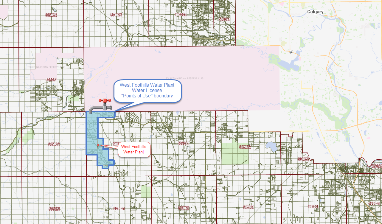
There is some concern that the Foothills MD may be looking to move existing water licenses designated for areas along HWY 762 over to Priddis. This survey is to guage Hwy 762 community interest in maintaining water licenses within the general boundaries shown on the maps below
This survey was initiated in April 2024, early survey results can be viewed via the link below. Your help in completing this survey would be greatly appreciated.
****Click Here to see Survey Results Updated as of November 1st 2024**** Thank you to all who have filled in the survey. Please help us by inviting your neighbors to complete the survey..
Our goal is accurately determine resident interest in retaining the existing water licenses designated for the West foothills license area
Map Instructions
Map Location
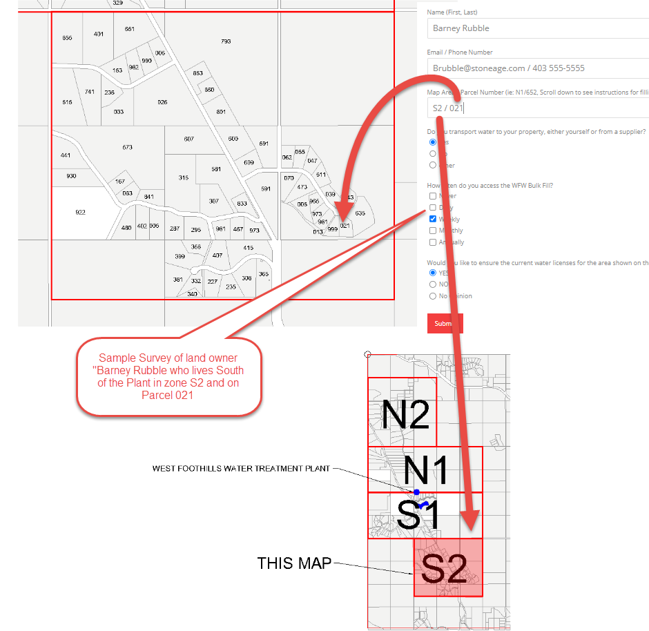
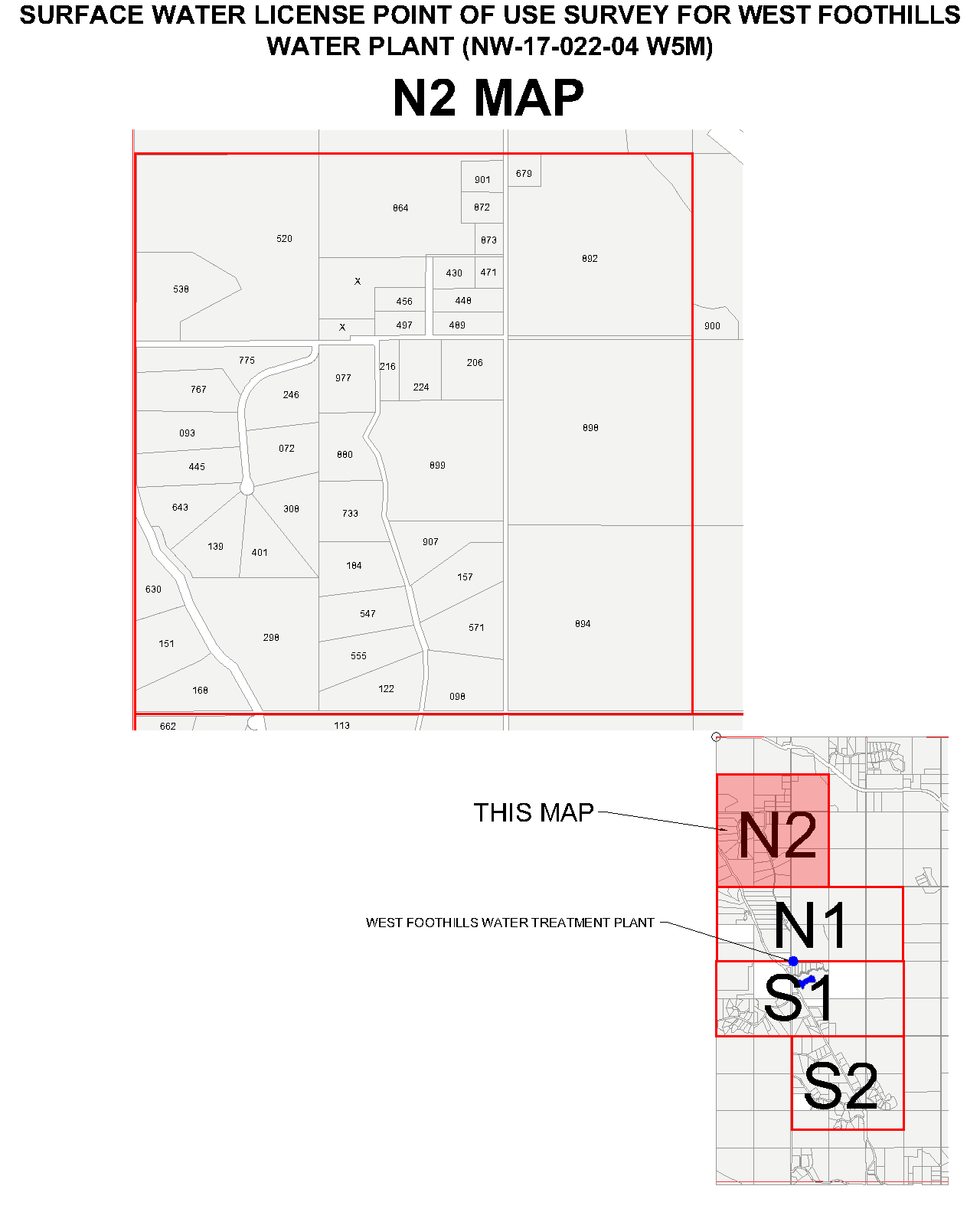
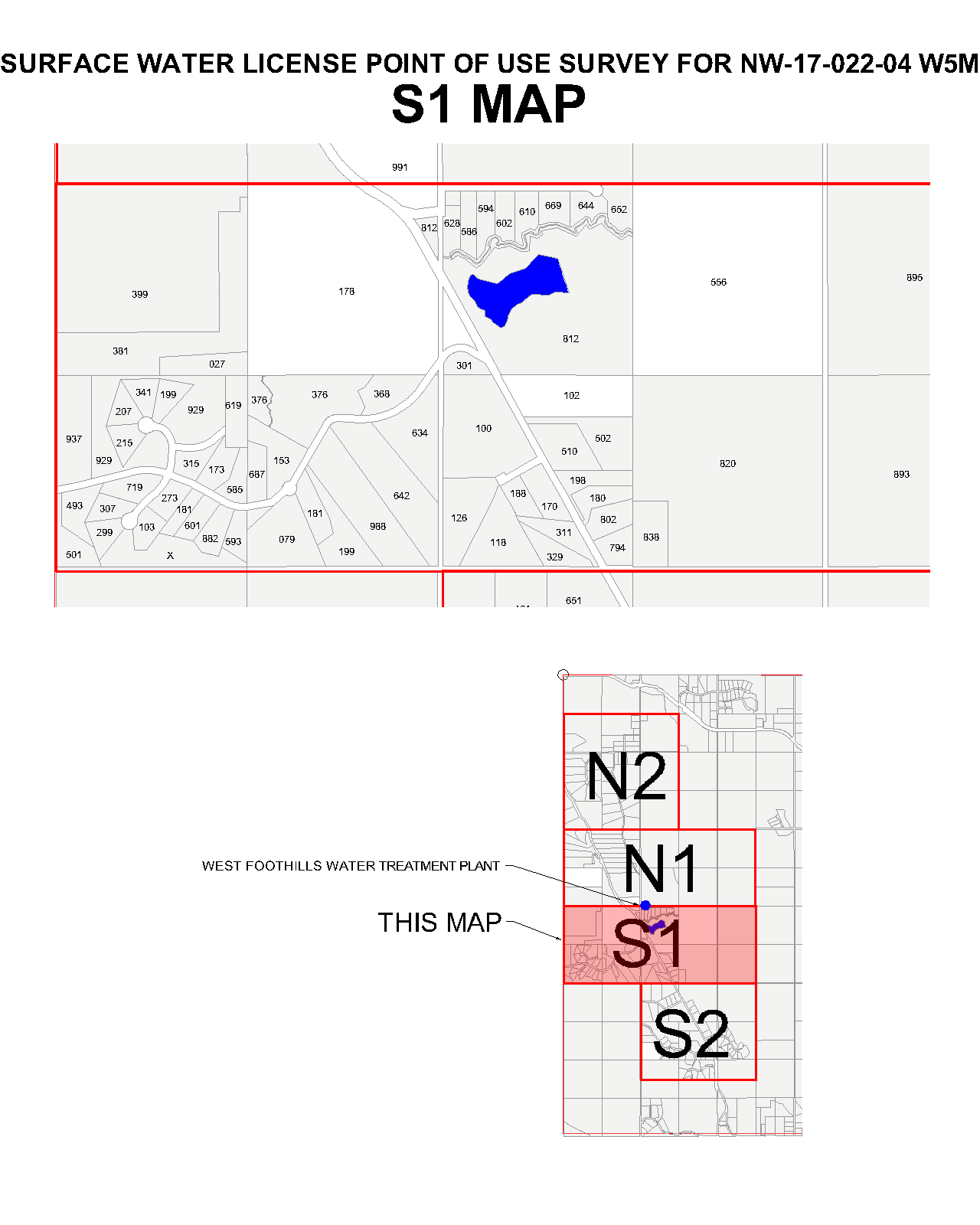
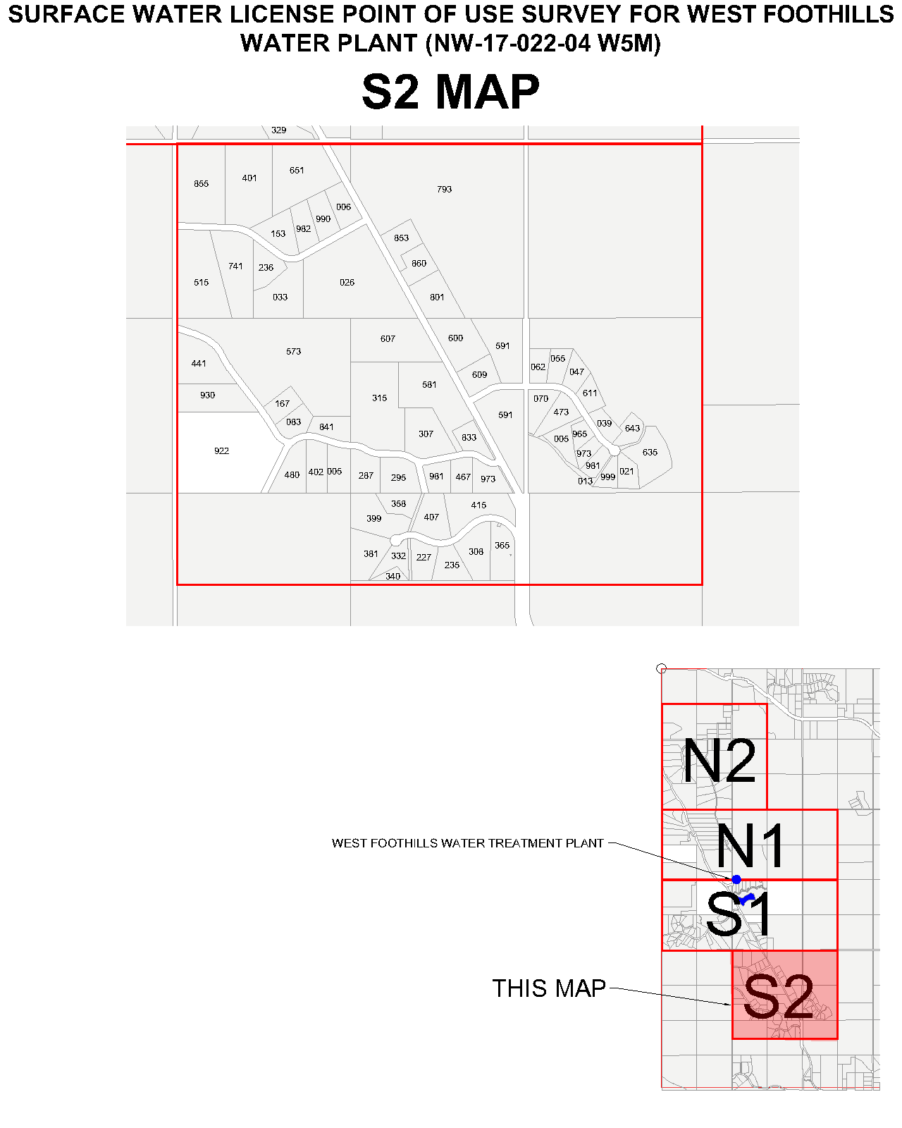
- Determine what area you are in by opening the overall map with , N1, N2, S1 and S2 color coded areas. If you live North of the Plant you will be in either N1 or N2. If you live South of the Plant you will be in either S1 or S2.
- Don’t worry if you are not within the license boundaries, just enter your address or describe general location, and we will contact you for more detail so we can populate our “blue zone” map.
- Open your specific area map and note the 3 digit number on your land parcel
- Record your Area and parcel number in the survey (ie: S2 / 021)
Overall Map (click to enlarge)
Hint: N=North of the plant S=South of the plant

Area Maps (click to enlarge)

Survey Results from 2024-11-01.
Help us turn West Foothills into a blue zone 😉